Breathing new life into old records
This year we decided to put our old aerial photographs to use, to create an insightful new resource…
…but first, a little bit about me and my role.
I’m the digital preservation trainee, and I’m here on a year-long placement thanks to the British Museum’s ‘Museum Futures’ programme, which aims to get young people working in museums with digital skills.
In my unique position I am based with the Archaeology team at the Museum of Liverpool, and we have lots of digital information surrounding our collection objects that need looking after to ensure their long-term preservation. Things such as photographs, drawings, site plans and reports – a whole wealth of digital information that needs to be preserved, so I do a lot of organising of the archives.
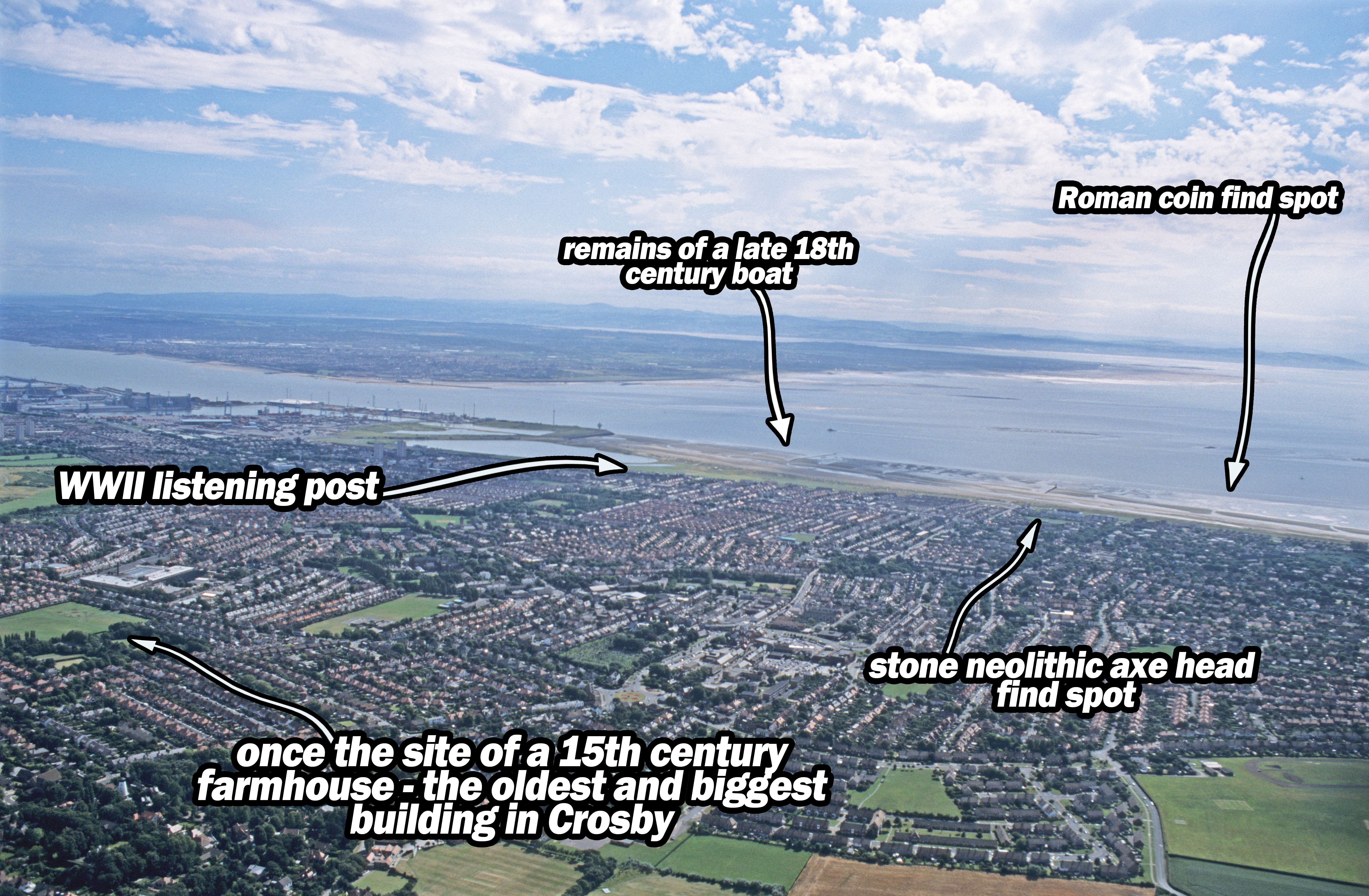
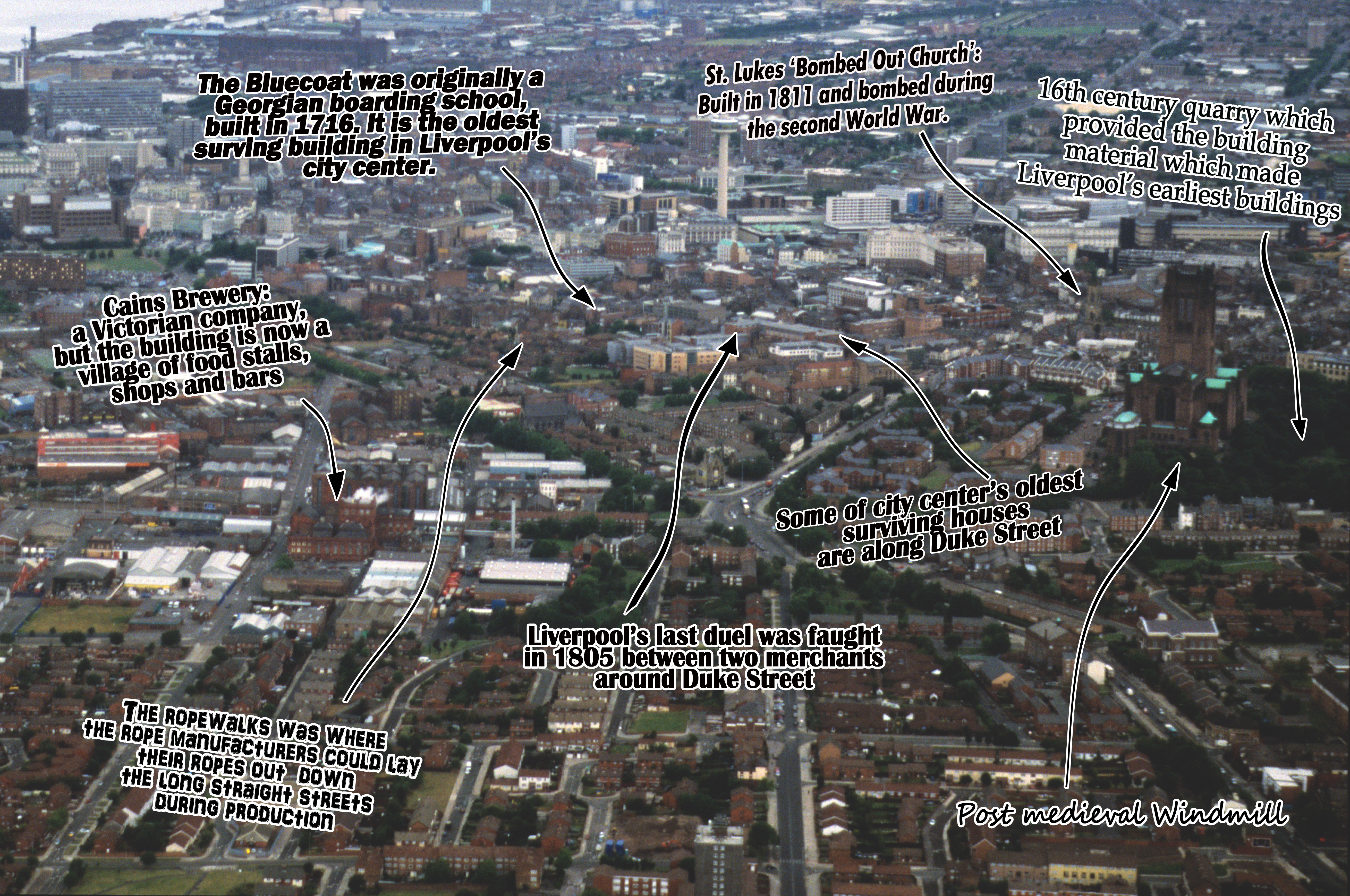
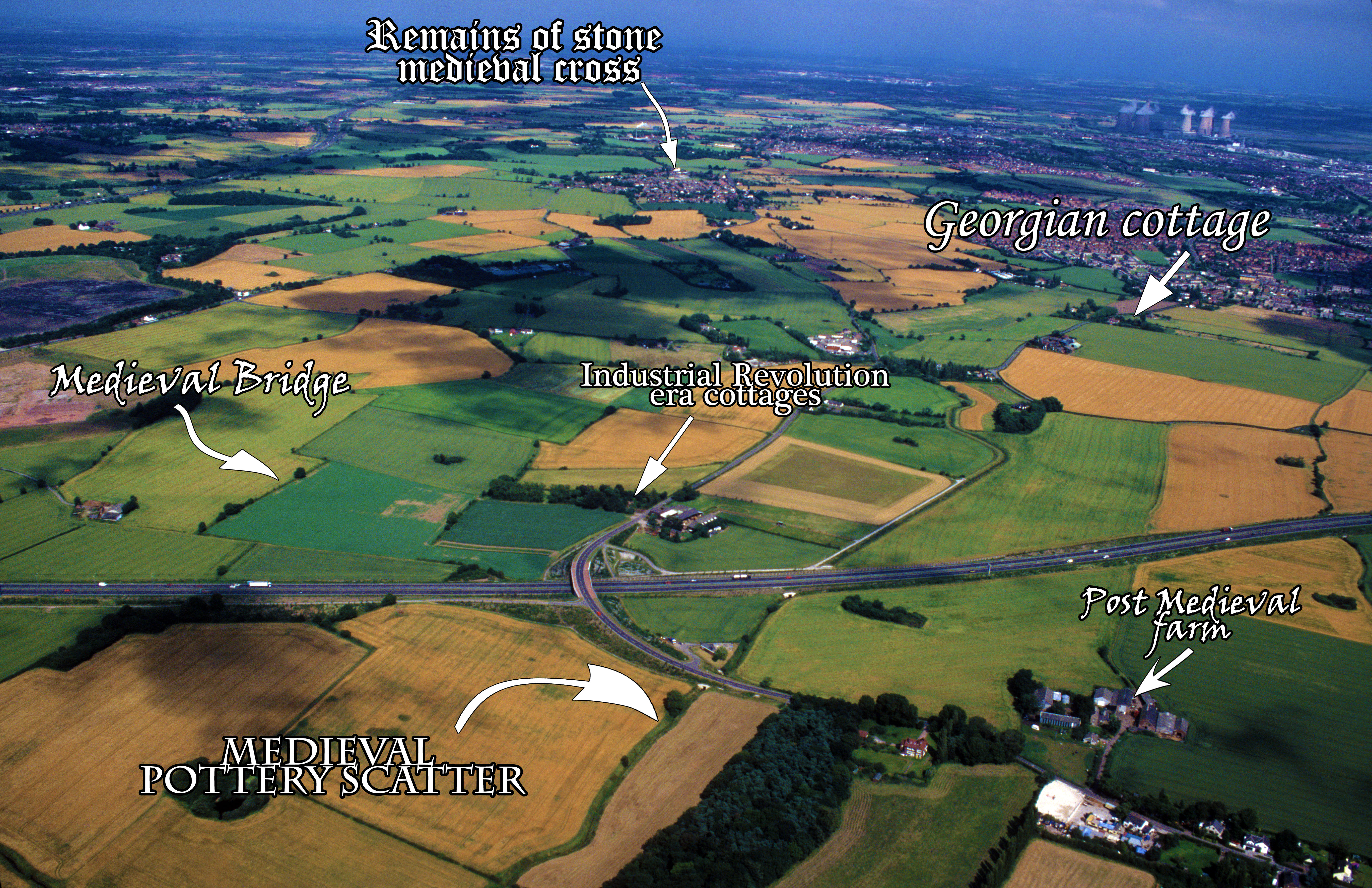
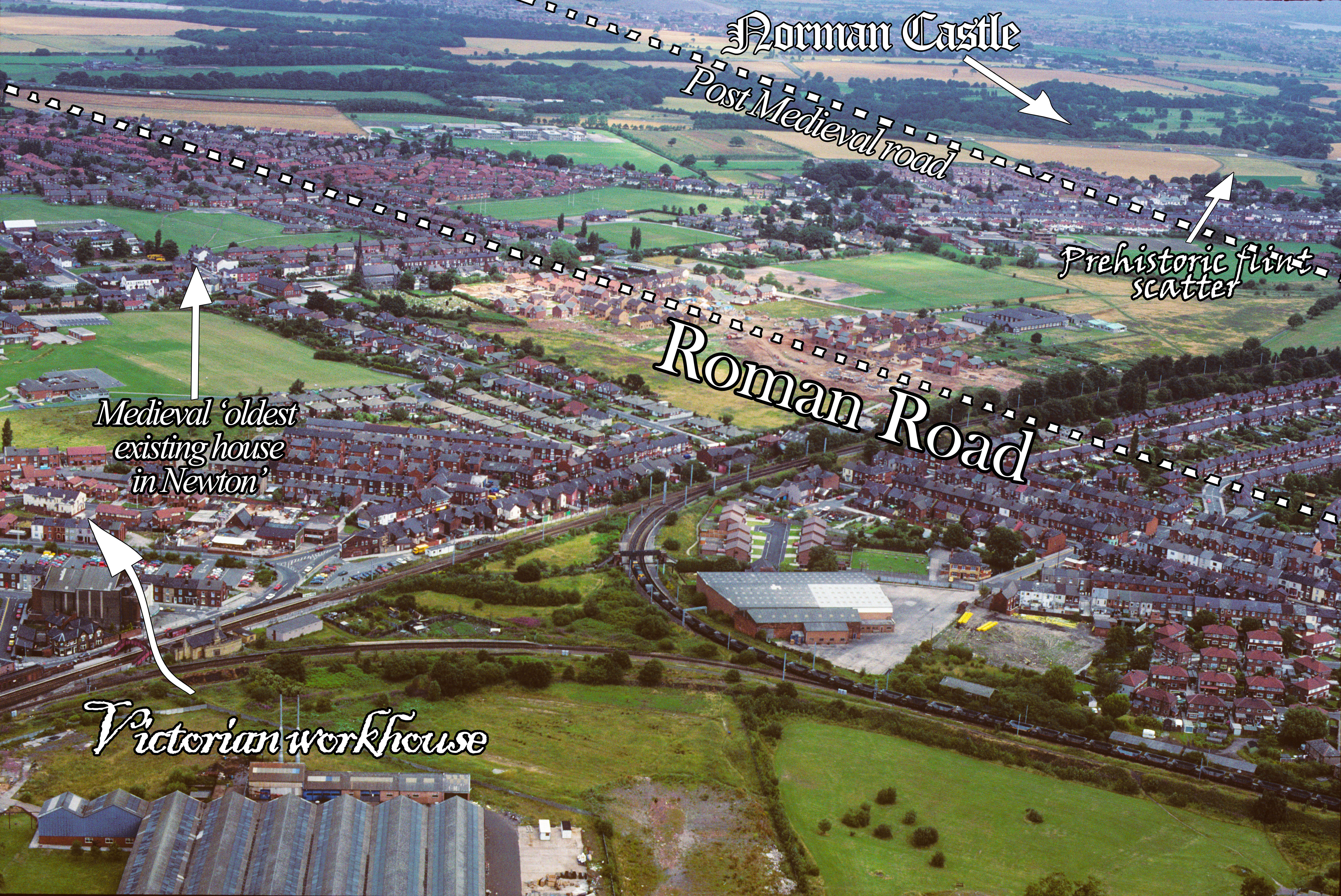
One thing I have worked on this year however is a little bit different – along with the help of Hope University Museum and Heritage Studies student Alkistis Kamadeli we have created interpretive images using old aerial photography slides and historic environment records to label Merseyside’s exciting history.
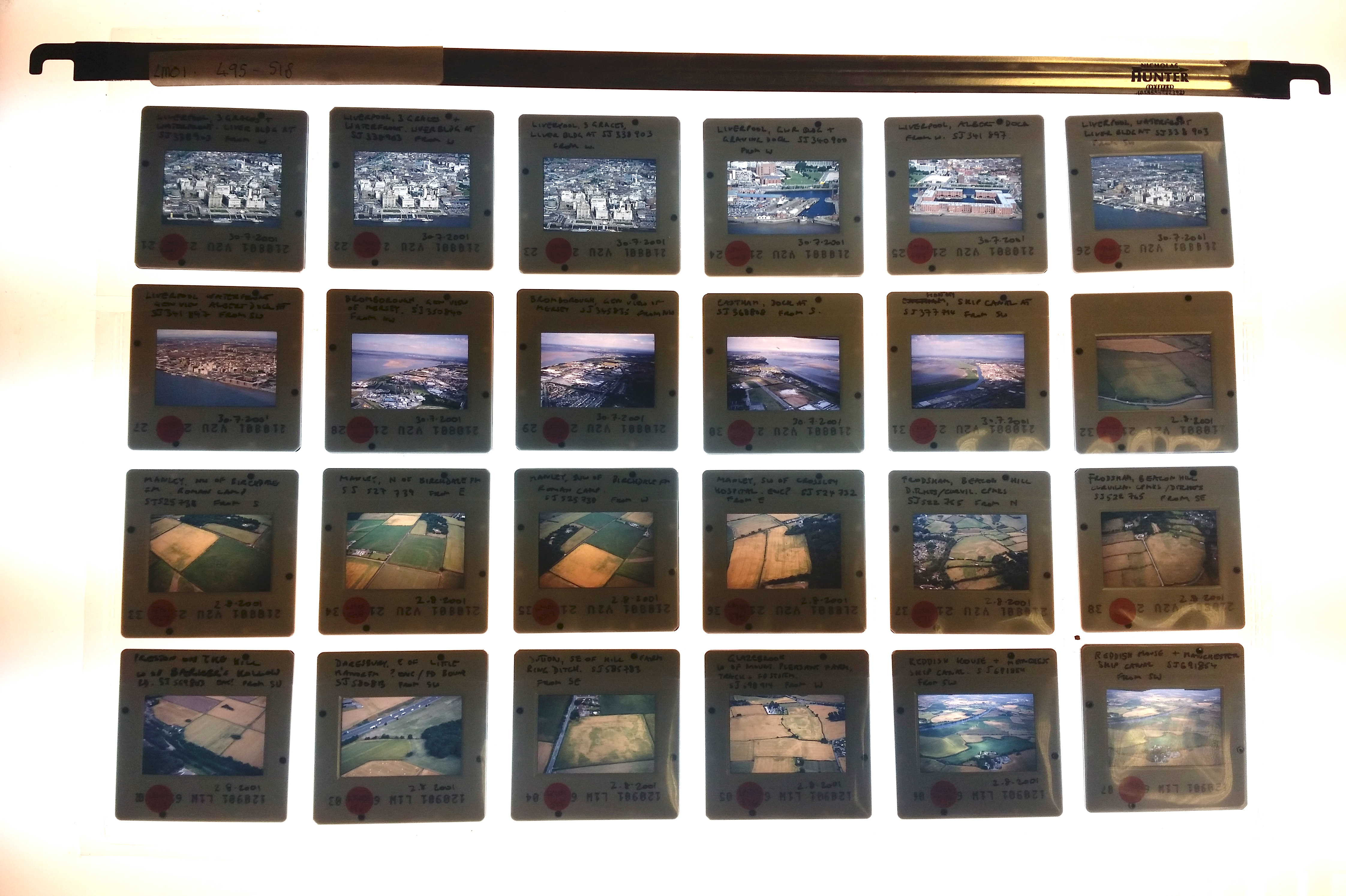
Archaeologists use aerial photography to spot signs of old building remains, hill forts and mysterious cropmarks, as well as documenting the landscape as it is today – and from the 80’s until the early 00’s, the archaeology team took thousands, all on tiny 35mm film slides.
First off, I went through all of these slides and chose one or two from each borough of Merseyside: the Wirral, Liverpool, Sefton, Knowsley and St. Helens, for us to label.
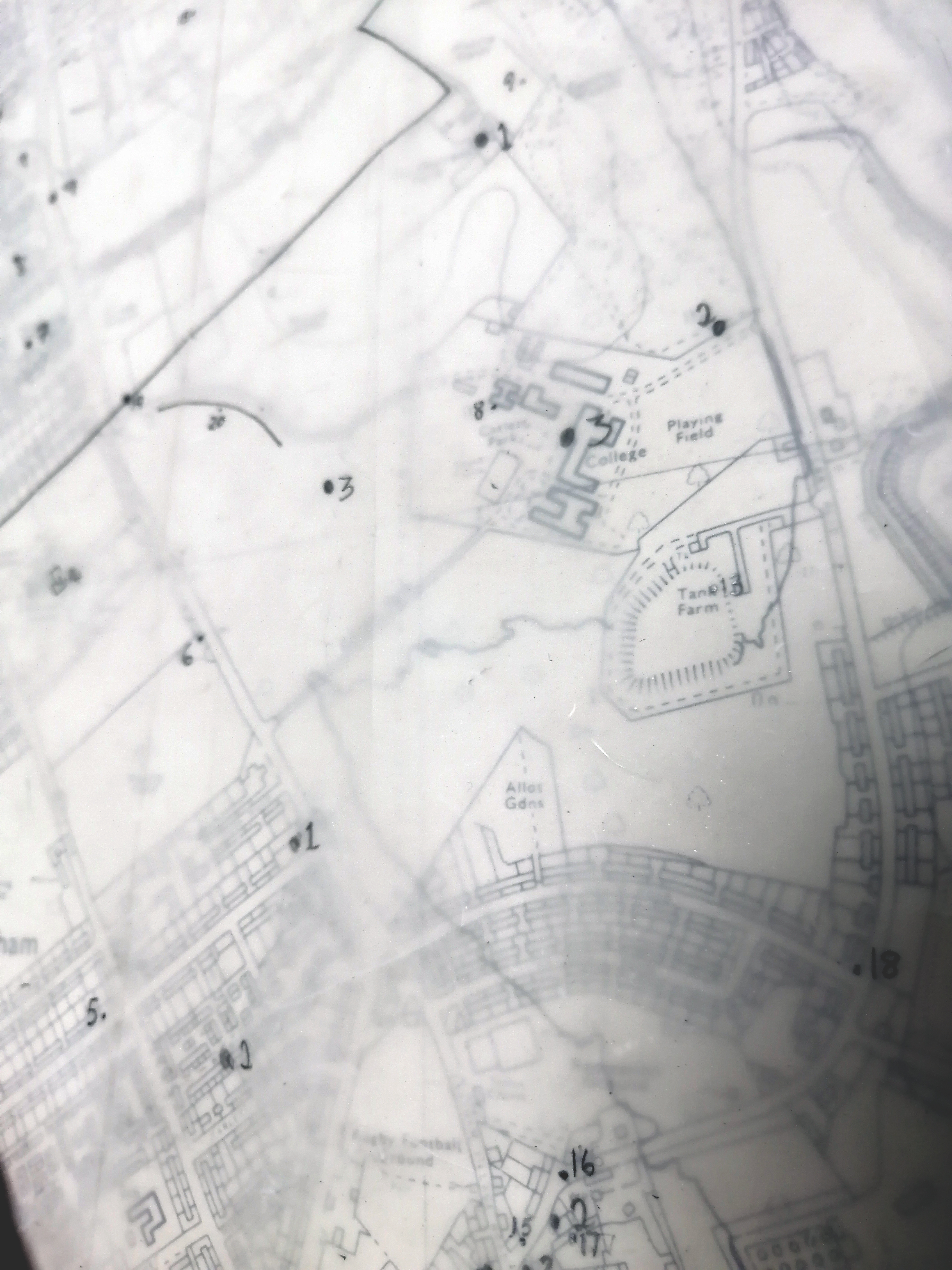
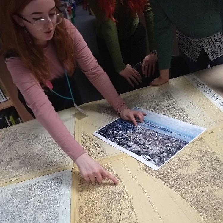
Once we figured out where in that county the photo was taken, we got out our OS maps to see what exactly we could see in the photos, then we have tracing paper with small numbered dots which when overlaid onto the map, highlight the spots where we have a corresponding historic environment record.
We looked through every single one of these records to pick out the ‘highlights’ that would make it on to the final image. There were so many interesting records of medieval roads and Victorian farmhouses, so it really was a struggle not to include them all (maybe we will one day). When we had six or so records that covered pre-history to modern day, we took it to the editing suite!
After making everything look a bit brighter and bolder, we now have labelled photos covering all of history around all of Merseyside! Take a look: